
The Chief Ladiga Trail is a rail-trail located in northeast Alabama. It runs between a southwestern terminus near Aniston, Alabama up to the northeast for 32 miles until it meets the 60-mile long Silver Comet Trail at the Alabama-Georgia border. Together the Chief Ladiga and Silver Comet rail trails provide a 90+ mile continuous, paved trail between Aniston, Alabama and Atlanta, Georgia.
History
Who Was Chief Ladiga?
Chief Ladiga was a leader of the indigenous Creek nation. He signed the 1832 Cusseta Treaty, surrendering the tribe’s remaining land in the area to the US Government. As part of the treaty, individual Creeks and their leaders were to be granted land claims in the former Creek territory. Chief Ladiga ultimately sold his land claim, some of which comprised the modern-day city of Jacksonville, Alabama.
Today’s Trail
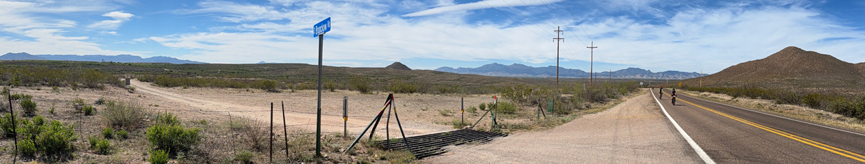
The Chief Ladiga Trail travels from the Alabama/Georgia border, west to Piedmont, then on to Jacksonville, passing through the Jacksonville State University campus. Then, the trail goes on to Weaver and finally ending at Michael Tucker Park in north Anniston. It travels through wetlands, across streams, through forests and farmlands.
It was Alabama’s first rail-trail project and is named after a famous 20th century passenger train by the same name operated by the Seaboard Air Line (SAL). In 1989, CSX – the then owner of the railroad – abandoned the line. Subsequently, in 1990 work began on the first part of the trail outside of Anniston, Georgia. The final section of the trail was completed in 2007.
Engineering pre-work has commenced to extend the trail 7.2 miles from Michael Tucker Park southward to 4th street in downtown Anniston.
My Experience

In June of 2020, I chose to ride the Chief Ladiga Trail from the Alabama/Georgia state line to the trail-end in Weaver, Alabama. We travelled from our home in Tennessee to Aniston, Alabama where we spent the night prior to riding the trail.
On the day of the ride Señora Trail ferried me to the Esom Hill trailhead, about 1 mile east of the Alabama/Georgia border. It was here that I began my ride westward, back to Aniston.


A word of warning here… There have been ongoing reports of vehicle vandalism at the Esom Hill trailhead, so parking an unattended vehicle there is likely not advisable. Also, care should also be taken for personal safety. Personal discussions with former local residents have confirmed that this area is one in which to exercise caution.
The trail is paved, though it can be rough in places due to tree roots tunneling under the trail as well as buckling due to extreme temperature variations. Here is a short video of my ride as I approach an intersection with one of the local roads.
The ride was pleasant, and went quickly. If I were to do it again, I would likely make it a 1 or 2-day ride, starting in Aniston and then ride past the Alabama/Georgia border connecting to the Silver Comet Rail Trail. My two sons-in-law did just that in 2021, riding the entire 90-mile Chief Ladiga/Silver Comet corridor from Aniston, Alabama to the Atlanta, Georgia area in one day.
My ride, however, terminated at the Southwestern terminus of the trail at Michael Tucker Park in Weaver, Alabama.

The best times of the year to do this ride are Spring through early-Summer and the Fall, avoiding oppressive summer heat and humidity and the cold winter.
Virtual Riding with Kinomap
I video my rides and then edit and syncronize them with the GPS track of the ride. I then add the GPS-syncronized and tagged video to the Kinomap app video library.
The Kinomap app, which is available for iPhone and Android, allows people with a smart bike trainer, or even a not smart trainer, or an exercise bike, or even an elliptical trainer, to experience the Chief Ladiga Trail virtually in the comfort of your own home, whenever desired.
The advantage of using a “smart” exercise device is that the Kinomap app on your Android or iOS device can control the difficulty level based on linked GPS data while you exercise.
Here are links to Kinomap videos of my ride of the Chief Ladiga Trail:
Resources
There are a few websites dedicated to providing information about the Chief Ladiga Trail. Here are a few: